Ireland
 UK
UK Scotland
 London

Land and Aerial Surveys


Address
21 Beech Park
Waterford
Ireland
About Land and Aerial Surveys
We have managed to continue growth & development by providing detailed, precise & fast surveys for our clients in Ireland at a cost-effective price.
After obtaining a diploma in Mineral Engineering at AIT, Carl went on to obtain an honours degree in Mineral Surveying at Glamorgan University in the UK.
Having gained a lot of experience surveying in the UK, Australia, and Ireland, Carl decided to establish Land and Aerial Surveys and now has a small team of experienced and dedicated surveyors working for the company.
ALL ABOUT TOPOGRAPHICAL SURVEYS
If you landed here, you are one of these kinds of visitors:
1. You are in the process of planning a project and require a topographical survey expert.
You are browsing the web to gather more information about surveyors in Ireland. If this is the case, drop us an email and provide the details of your project. Step by step, we’ll define the best quote for you.
2. Curiosity led you here. Then keep reading to learn everything you need to know about topographic surveys.
At Land and Aerial Surveys, we have a combined experience of over 30 years in gathering topographical and hydrographic survey data using the most up-to-date robotic total stations, scanners, GPS and surveying software to ensure a fast and cost-effective field-to-finish solution. The final processed data can be supplied in various formats.
Our client's needs vary from a one-off home boundary survey to large surveys for the purpose of construction design.
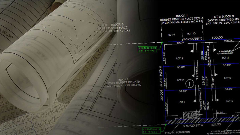
Measured Building Surveys
Measured building surveys utilise some of the more traditional approaches to building surveys while also using some of the latest technology. Here is everything you need to know about a measured building survey.
A measured building survey provides the most accurate representation of a building, which allows you to better see the various architectural and structural elements of the property. In general, a measured build survey will consist of three separate elements:
Aerial Surveys
At Land and Aerial Surveys we can provide a professional aerial surveying service for your project. This can range from a simple aerial photograph of a plot of land to a large hi-resolution stitched image, with cm accuracy.
Our Clients range from small homeowners looking to view damaged roofs to SME businesses wanting photographs of their property for website etc.
Consulting companies and civil contractors have been using our aerial services for volume surveys (DTM, DSM models) as we can fly large sites which would normally take a surveyor many days to obtain the information by GNSS. Many of our construction clients are using us for the inspection of bridges and difficult-to-reach structures.
Quarries continue to use our SUA’s (Small Unmanned Aircraft) for planning, design and stockpile quantities. It is becoming more and more common to use these methods in the aggregate industry.
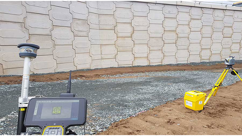
Setting Out And Engineering Surveys
The specialised field of setting out requires an experienced team of qualified engineering surveyors using high-specification surveying equipment in order to achieve the necessary accuracy.
At Land and Aerial Surveys we use the highest accuracy 1″ Total Stations for mm accuracy where you need it.
Engineering surveys are a vital aspect of any new build or construction project. Without this information, it would be impossible for contractors to complete the building requirements and meet regulations.
So, let’s take a closer look at everything you need to know about this process and how it works.
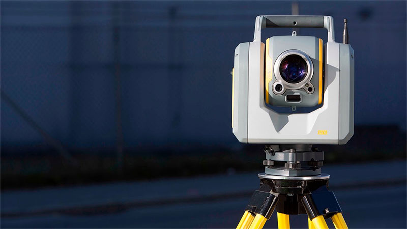
3D LASER SCANNING
Land and Aerial Surveys have always been keen on keeping up to date with the latest surveying technology.
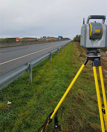
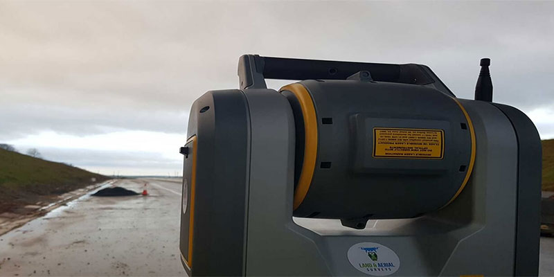
Laser scanning allows us to gather information (dense point clouds) that may not usually be obtained by using regular surveying technology and by doing this we can very accurately survey high-rise structures, detailed building facades, live motorways and railways without the need for traffic management controls.
We also offer our scanning services for
- Deformation Analysis
- Floor Flatness Analysis and Contour Mapping
- Point Cloud Modelling
- Clash Detection
MONITORING AND VOLUMETRIC SURVEYS
Land and Aerial Surveys have been hired by many companies over the years to monitor specific objects ranging from quarry faces, retaining walls, bridge structures and road surfaces.
At Land and Aerial Surveys, we use the most precise equipment available, Trimble’s SX10, 1 Second accuracy total station scanner for all our monitoring and volume surveys.
All our employees have been trained to the highest standard using this equipment, giving our clients the reassurance that the best people, using the best equipment are giving them the best results.
Gallery

Facebook Feed
Location Map
Find Land and Aerial Surveys in