Ireland
 UK
UK Scotland
 London

Digital Surveys LTD

Telephone
Click to view
Mobile
Click to view
Website
Contact
Marius Fador
Email
Address
29 ARDSOLUS
OLD NAAS ROAD
OLD NAAS ROAD
Dublin
County Dublin
Dublin
Ireland
About Digital Surveys LTD
Who We Are
We are a young company set up by two experienced Land Surveyors:
Simona Fador brings the company more than ten years experience in processing data from laser scanners, drones and total stations. Her experience in using the latest software help us to provide solutions with high level of accuracy and precision. Also, Simona has a Level 2 BIM Certificate obtained at Dublin Institute of Design which certifies her skills in 3D modeling and BIM projects.
Marius Fador brings with him, his experience on sites, more than ten years experience as a Land Surveyor in civil and road projects in Europe and Africa. His experience in managing projects from the Setting-out point of view recommend us as a trustful partner on construction sites. Also, Marius is a licensed Drone Pilot and experienced laser scanner user.
Our goal is to implement the new surveying technology in every project and to increase the level of information our clients receive from us.
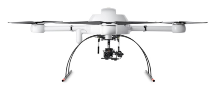
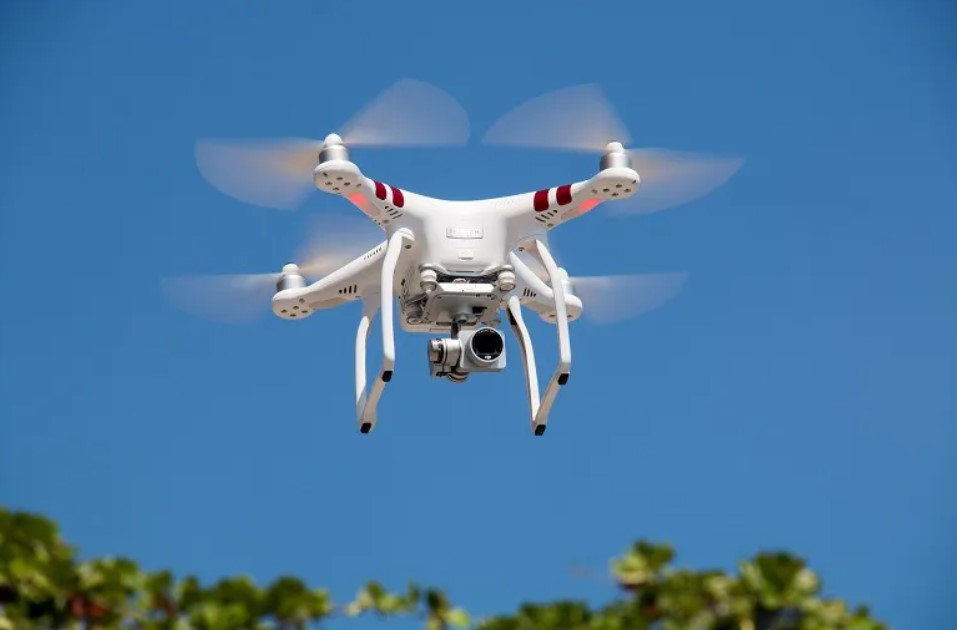
UAV SURVEYS SERVICES
The UAV surveys improve the level of data collected from the field, being a complete solution for project planning, ground control, image acquisition, processing and reporting.
The UAV surveys are a safe and efficient method for capturing large areas of survey data with a high accuracy surveying method.
We provide this service for: surveying, mapping, volume calculation, georeferenced orthophotography, visualisation, simulation and inspection.
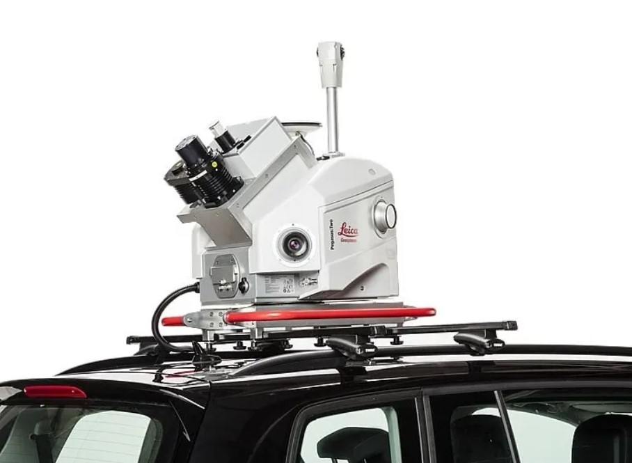
MOBILE MAPPING SYSTEM SERVICES
This new survey system is capable of capturing vast amounts of survey grade data and imagery over complex and large projects in a short period of time. A huge improvement of this system in the surveying business is because no traffic management is needed or shutdowns on sites during the operation.
Applications for mobile mapping includes: Roads, grade separations and design, Infrastructure and maintenance, Rail, Power line mapping.
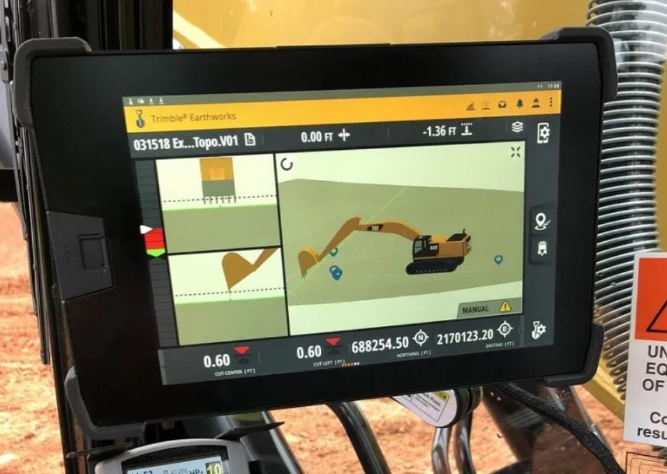
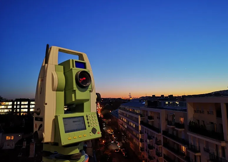
TOPOGRAPHIC SURVEY SERVICES
The purpose of a topographic surveys is to collect survey data about the natural and man-made features of the land, as well as it’s elevation.
We can provide 2D/3D Drawings, PDF files, DTM Models, Asci files with measured points coordinates, cross sections and long sections.
TECHNOLOGY IS THE NEW SURVEY
Contact us to request an estimate or for general questions.
GET A QUOTE
We are a young company set up by two experienced Land Surveyors:
Simona Fador brings the company more than ten years experience in processing data from laser scanners, drones and total stations. Her experience in using the latest software help us to provide solutions with high level of accuracy and precision. Also, Simona has a Level 2 BIM Certificate obtained at Dublin Institute of Design which certifies her skills in 3D modeling and BIM projects.
Marius Fador brings with him, his experience on sites, more than ten years experience as a Land Surveyor in civil and road projects in Europe and Africa. His experience in managing projects from the Setting-out point of view recommend us as a trustful partner on construction sites. Also, Marius is a licensed Drone Pilot and experienced laser scanner user.
Our goal is to implement the new surveying technology in every project and to increase the level of information our clients receive from us.
UAV SURVEYS SERVICES
The UAV surveys improve the level of data collected from the field, being a complete solution for project planning, ground control, image acquisition, processing and reporting.
The UAV surveys are a safe and efficient method for capturing large areas of survey data with a high accuracy surveying method.
We provide this service for: surveying, mapping, volume calculation, georeferenced orthophotography, visualisation, simulation and inspection.
MOBILE MAPPING SYSTEM SERVICES
This new survey system is capable of capturing vast amounts of survey grade data and imagery over complex and large projects in a short period of time. A huge improvement of this system in the surveying business is because no traffic management is needed or shutdowns on sites during the operation.
Applications for mobile mapping includes: Roads, grade separations and design, Infrastructure and maintenance, Rail, Power line mapping.
TOPOGRAPHIC SURVEY SERVICES
The purpose of a topographic surveys is to collect survey data about the natural and man-made features of the land, as well as it’s elevation.
We can provide 2D/3D Drawings, PDF files, DTM Models, Asci files with measured points coordinates, cross sections and long sections.
TECHNOLOGY IS THE NEW SURVEY
Contact us to request an estimate or for general questions.
GET A QUOTE
Gallery
Location Map
Digital Surveys LTD Serves The Following Counties
Digital Surveys LTD Serves The Following Towns