Ireland
 UK
UK Scotland
 London

Drone Solutions Ireland
Address
Unit 3D, Northpoint House
Northpoint Business Park
Northpoint Business Park
Cork
Munster
T23AT2P
Ireland
Drone Services Aerial Mapping Aerial Inspections
About Drone Solutions Ireland
Drone Solutions Ireland, based in Northpoint Business Park, Cork, is a leading provider of drone services for the construction industry across Ireland. We specialize in aerial surveys, progress monitoring, thermal inspections, and high-quality photography, helping contractors and developers work smarter, safer, and more efficiently.
Our team of certified UAV pilots operates under the Specific Category, fully compliant with Irish Aviation Authority (IAA) regulations. Using DJI Enterprise drones, we deliver accurate data and stunning visuals to support every stage of your project.
Our Services Include:
Aerial Surveys & Mapping – Orthomosaic maps, 3D models, for precise planning.
Progress Monitoring – Regular aerial updates for improved transparency and reduced site visits.
Thermal Inspections – Advanced thermal imaging to detect heat loss, moisture ingress, and electrical faults in buildings and infrastructure.
Photography & Videography – Professional aerial visuals for marketing and documentation.
Why Choose Drone Solutions Ireland?
Certified pilots with industry expertise.
Advanced drone technology for reliable results.
Nationwide coverage with fast turnaround times.
Commitment to safety and compliance.
Our team of certified UAV pilots operates under the Specific Category, fully compliant with Irish Aviation Authority (IAA) regulations. Using DJI Enterprise drones, we deliver accurate data and stunning visuals to support every stage of your project.
Our Services Include:
Aerial Surveys & Mapping – Orthomosaic maps, 3D models, for precise planning.
Progress Monitoring – Regular aerial updates for improved transparency and reduced site visits.
Thermal Inspections – Advanced thermal imaging to detect heat loss, moisture ingress, and electrical faults in buildings and infrastructure.
Photography & Videography – Professional aerial visuals for marketing and documentation.
Why Choose Drone Solutions Ireland?
Certified pilots with industry expertise.
Advanced drone technology for reliable results.
Nationwide coverage with fast turnaround times.
Commitment to safety and compliance.
Gallery
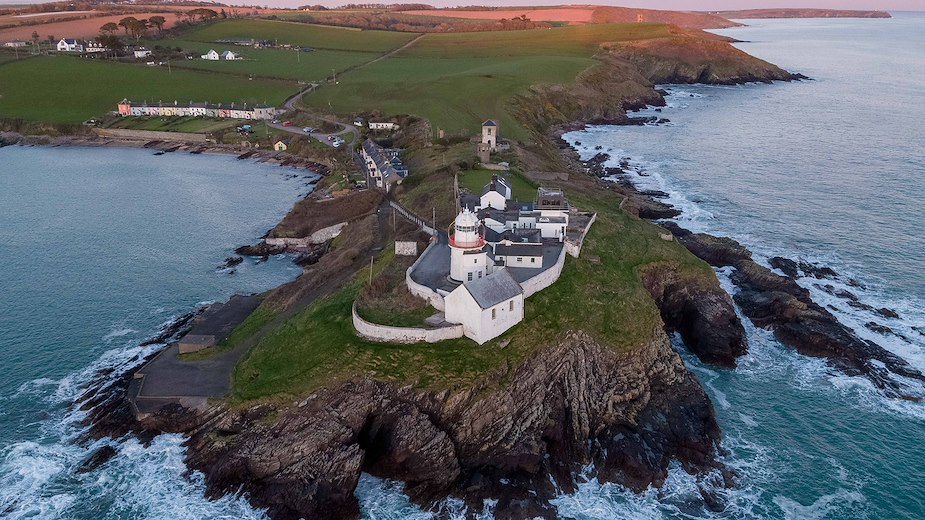
Aerial Photography
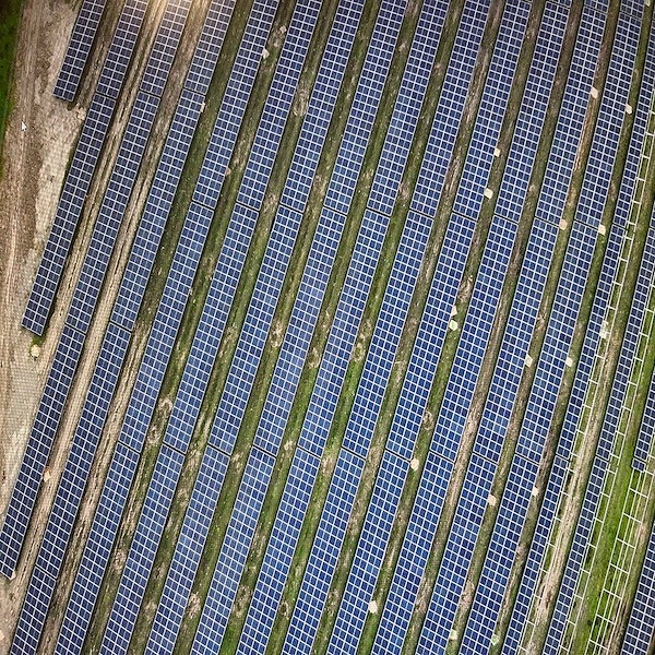
Solar panel inspection
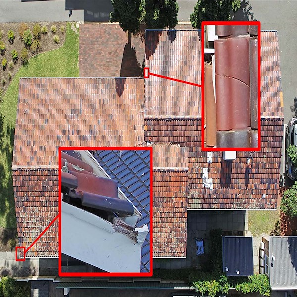
Roof inspection by drone
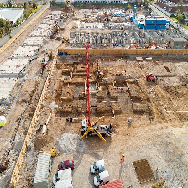
Progress Rerports of a construction site
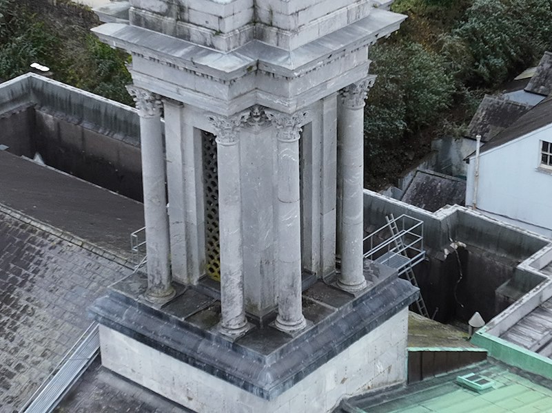
church spire inspection by drone
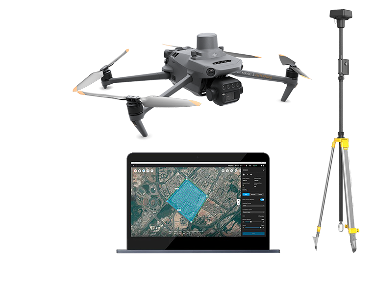
drone mapping using rtk and gcp's
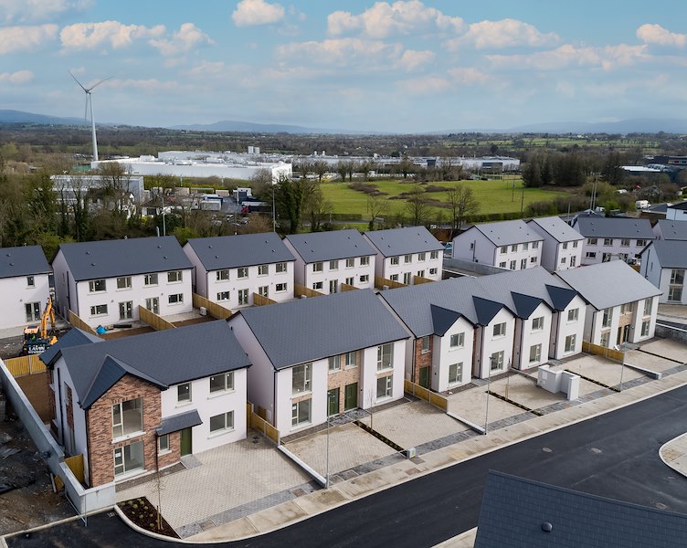
aerial photography of a new development
News
Drone Solutions Ireland has built a reputation for delivering precision, safety, and innovation through aerial technology. Known for high quality inspections, mapping, and photography, the company has now expanded its services to include advanced thermal drone inspections powered by the DJI Matrice 4T.
This new capability allows for non invasive, efficient, and highly accurate assessments of infrastructure and assets. Using the Matrice 4T’s integrated thermal sensor, inspections can detect heat anomalies, insulation issues, electrical faults, and moisture ingress with exceptional clarity. The drone captures both visual and thermal data simultaneously, enabling comprehensive reporting and faster decision-making.
Thermal inspections are valuable across a wide range of industries, including construction, utilities, and agriculture. Whether identifying overheating components, surveying rooftops for energy efficiency, or supporting preventative maintenance, Drone Solutions Ireland provides a reliable and cost-effective solution.
The DJI Matrice 4T is engineered for performance and safety. With extended flight time, advanced obstacle avoidance, and real time data transmission, it ensures precise operations even in challenging conditions.
This allows clients to gain actionable insights without disruption to their workflow.
At Drone Solutions Ireland, the mission is to deliver aerial intelligence that empowers smarter decisions. With the addition of thermal inspections, the company continues to push the boundaries of what’s possible bringing cutting edge drone technology to the forefront of inspection services.
This new capability allows for non invasive, efficient, and highly accurate assessments of infrastructure and assets. Using the Matrice 4T’s integrated thermal sensor, inspections can detect heat anomalies, insulation issues, electrical faults, and moisture ingress with exceptional clarity. The drone captures both visual and thermal data simultaneously, enabling comprehensive reporting and faster decision-making.
Thermal inspections are valuable across a wide range of industries, including construction, utilities, and agriculture. Whether identifying overheating components, surveying rooftops for energy efficiency, or supporting preventative maintenance, Drone Solutions Ireland provides a reliable and cost-effective solution.
The DJI Matrice 4T is engineered for performance and safety. With extended flight time, advanced obstacle avoidance, and real time data transmission, it ensures precise operations even in challenging conditions.
This allows clients to gain actionable insights without disruption to their workflow.
At Drone Solutions Ireland, the mission is to deliver aerial intelligence that empowers smarter decisions. With the addition of thermal inspections, the company continues to push the boundaries of what’s possible bringing cutting edge drone technology to the forefront of inspection services.
Drone mapping offers a precise and efficient way to create detailed, up-to-date geographic maps. By capturing high-resolution aerial imagery from various angles, drones generate accurate topographical and spatial data with remarkable detail. This technology enables rapid data collection over large areas, reducing the time and cost associated with traditional surveying methods. Drone mapping enhances project planning, analysis, and decision-making by providing a comprehensive and dynamic view of the terrain, infrastructure, and developments.
Drones are extensively used in land surveying to collect accurate, geo-tagged data quickly. Equipped with high-tech sensors and cameras, drones can capture images and data on the terrain below, which are then processed into high-quality 3D maps and models.
This method significantly improves the efficiency of data collection and processing, allowing for the creation of detailed 2D orthomosaics and 3D models.
To further enhance the accuracy of drone mapping, RTK (Real-Time Kinematic) technology is employed. RTK technology improves the precision of GPS positioning by using a fixed base station and a mobile unit, known as an RTK GNSS Rover, to correct the GPS signals in real-time. This results in centimeter-level accuracy, which is crucial for detailed mapping and surveying tasks.
Additionally, the RTK GNSS Rover is used to mark out the Ground Control Points (GCPs). These GCPs are reference points on the ground with known coordinates, which are used to georeference the aerial imagery captured by the drone. By accurately marking these points, the overall accuracy of the drone-generated maps is significantly improved, ensuring that the spatial data aligns correctly with real-world coordinates. This combination of drone mapping and RTK technology provides a powerful tool for creating highly accurate and reliable geographic maps.
Drones are extensively used in land surveying to collect accurate, geo-tagged data quickly. Equipped with high-tech sensors and cameras, drones can capture images and data on the terrain below, which are then processed into high-quality 3D maps and models.
This method significantly improves the efficiency of data collection and processing, allowing for the creation of detailed 2D orthomosaics and 3D models.
To further enhance the accuracy of drone mapping, RTK (Real-Time Kinematic) technology is employed. RTK technology improves the precision of GPS positioning by using a fixed base station and a mobile unit, known as an RTK GNSS Rover, to correct the GPS signals in real-time. This results in centimeter-level accuracy, which is crucial for detailed mapping and surveying tasks.
Additionally, the RTK GNSS Rover is used to mark out the Ground Control Points (GCPs). These GCPs are reference points on the ground with known coordinates, which are used to georeference the aerial imagery captured by the drone. By accurately marking these points, the overall accuracy of the drone-generated maps is significantly improved, ensuring that the spatial data aligns correctly with real-world coordinates. This combination of drone mapping and RTK technology provides a powerful tool for creating highly accurate and reliable geographic maps.
Team
| Name | Role | Telephone | |
|---|---|---|---|
| Richard Coleman | Director | [email protected] | 0867702658 |
Location Map
Find Drone Solutions Ireland in