Ireland
 UK
UK Scotland
 London


DeBurca Coastal Services
Address
Unit 1C McHale Retail Park
Castlebar
County Mayo
Connacht
F23WF57
Ireland
About DeBurca Coastal Services
Deburca Coastal Services Ltd specialises in aerial surveys of coastal and offshore structures. With over 15 years in offshore hydrography, we support the offshore renewable industry with advanced Unmanned Aircraft Systems (UAS).
15+ Years of Expertise:
Leveraging extensive offshore hydrography experience for precise aerial surveys.
Specialised in Offshore Renewables
Tailored services for the growing offshore renewable industry.
Detailed Planning
Shoots planned with a deep understanding of client needs and project requirements.
Certified Professional Pilots
All pilots are UAS OFQUAL Level 4 Certified, ensuring top-tier service and safety.
Renewables
Wind turbine inspections are an indispensable service to ensure the reliability, safety, and performance of wind farms. All wind turbine generator operations require regular maintenance and periodical inspections as over the years, all main components, from mechanical, civil, or electrical, suffer considerable wear that can affect the performance of the wind tower.
Offshore wind turbine inspections are even more dangerous, presenting unpredictable weather conditions that increase the risks to inspectors—not to mention the journey to get there and the fact that offshore wind turbines are taller than their land-based counterparts.
Insurance claims
One of the main advantages of using Unmanned Aircraft (UA) for insurance claims is the speed at which they can gather data. Traditionally insurers would have to physically visit the site of an incident to assess the damage. This process could be time consuming, especially in cases where the location was remote or inaccessible. However, Unmanned Aircraft (UA) can quickly and easily reach these areas, capturing detailed images and videos that can be used to assess the extent of the damage. This allows insurance companies to initiate the claims process promptly, reducing the waiting time for policy holders.
Photogrammetry
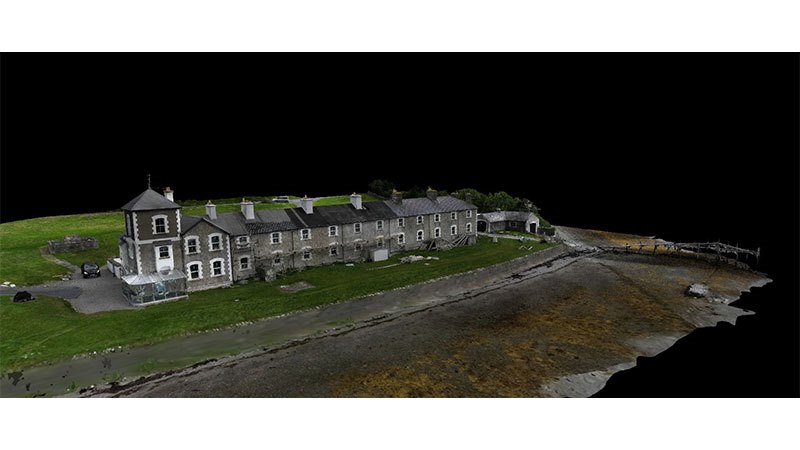
UAS based photogrammetry allows individuals to discover an alternative view to a worksite whether on land or offshore. The pilot in command can obtain reliable information about physical objects in the environment through the process of recording, measuring and interpreting photographic images and patterns of recorded radiant electromagnetic energy and other phenomena.
It makes it possible to see the same ground point from different angles and altitudes. From here one can create 3D maps that includes a range of useful cues, such as colours and textures. Photogrammetry is used in fields such as topographic mapping, architecture, filmmaking, engineering, insurance assessments, search and rescue along with offshore monitoring of installations during the construction phase.
Aerial Video Surveys
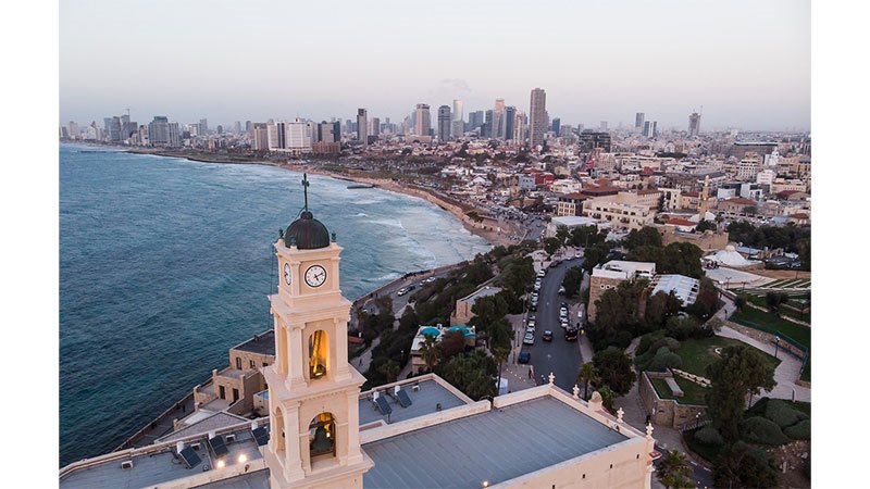
Aerial photography provisions was once only serviced by expensive helicopters and special masts or cranes, but now due to the introduction of innovative technology in small unmanned aerial systems the sky is a much cheaper and sampler environment to access and shoot from. Our unmanned aircraft can capture high-definition shots, we can provide image capture of any project or business requirement, creating a new and exciting aerial angle and perspective to your image requirements. Using highly advanced gimbal technology, photos are stabilised and captured at exceptionally sharp high quality.
Roof Inspections
Whether you’re inspecting a new roof following or during development or investigating water ingress or heat loss through to an insurance claim, its important to capture accurate image data efficiently and in a timely manner. We are happy to work alone or with your roofing specialist/company and can provide video feeds to ground personnel in real time for directions as required.
Thermal Imaging Surveys
Also known as infrared thermography (IRT), thermal imaging is the process of using thermal cameras to capture images of objects by using the infrared radiation (heat) emitted by these objects. The resulting thermal images (also known as thermograms) depict the spatial distribution of temperature differences in the scene captured by the thermal cameras.
Gallery
Location Map
Find DeBurca Coastal Services in





![Swords Auto [Traffic Management]](http://www.construction.co.uk/advnew/489306bul.jpg)